|
Orienteering
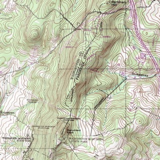
Orienteering Skills A topographic map tells you where things are and how to get to them, whether you're hiking, biking, hunting, fishing, or just interested in the world around you. These maps describe the shape of the land. They define and locate natural and manmade features like woodlands, waterways, important buildings, and bridges. They show the distance between any two places, and they also show the direction from one point to another.
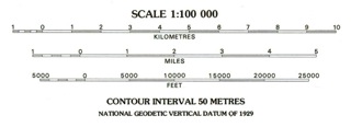
Distances and directions take a bit of figuring, but the topography and features of the land are easy to determine. The topography is shown by contours. These are imaginary lines that follow the ground surface at a constant elevation: they are usually printed in brown, in two thicknesses. The heavier lines are called index contours, and are usually marked with numbers that give the height in feet or meters. The contour interval, a set difference in elevation between the brown lines, varies from map to map; its value is given in the margin of each map. Contour lines that are close together represent steep slopes. Natural and manmade features are represented by colored areas and by a set of standard symbols on all U.S. Geological Survey (USGS) topographic maps. Woodlands, for instance, are shown in a green tint, waterways, in blue. Buildings may be shown on the map as black squares or outlines. Recent changes in an area may be shown by a purple overprint. A road may be printed in red or black solid or dashed lines, depending on its size and surface.
Orienteering Skills If, for instance, 1 inch on the map represents 1 mile (which converts to 63,360 inches) on the ground, the map's scale is 1:63,360.
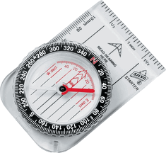
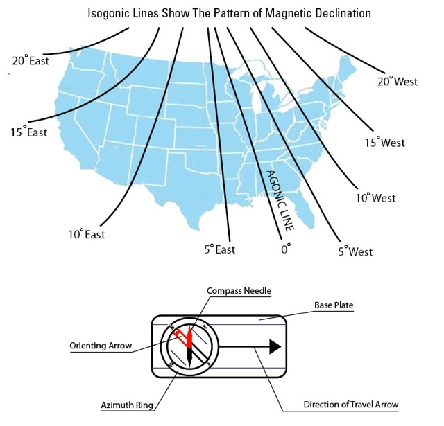
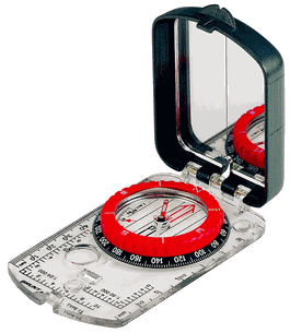
Orienteering Skills One thing to remember is that a compass does not really point to true north, except by coincidence in some areas. The compass needle is attracted by magnetic force, which varies in different parts of the world and is constantly changing. When you read north on a compass, you're really reading the direction of the magnetic north pole. A diagram in the map margin will show the difference (declination) at the center of the map between compass north (magnetic north indicated by the MN symbol) and true north (polar north indicated by the "star" symbol). This diagram also provides the declination between true north and the orientation of the Universal Transverse Mercator (UTM) grid north (indicated by the GN symbol). The declination diagram is only representational, and true values of the angles of declination should be taken from the numbers rather than from the directional lines. Because the magnetic declination is computed at the time the map is made, and because the position of magnetic north is constantly changing, the declination factor provided on any given map may not be current. Click here
to find the magnetic declination for your area. **Don't forget to set your magnetic declination on your compass before using it in the field!
courtesy USGS
1. Draw a straight line on the map passing through your location and your destination and extending across any one of the map borders. Be careful to get the have your compass pointing in the correct direction (direction of travel) because a straight line will have two values 180 degrees apart. Remember north is 0, east is 90, and so on.
Caution
Navigational Techniques
Orienteering Methods
Course Navigations
Attack Points
Attack points are used for confirming positions on a map, or jumping off points to begin Dead Reckoning to target.
Collecting Features
Catching Features
Aiming Off
For more information on orienteering please visit
Return from "Orienteering" to "Navigation"
|
